Ruta Maya (Guatemala, Mexico & Belize)
The Ruta Maya strings the great Maya cities of southern Mexico, Guatemala, Belize and western Honduras together with volcanoes, highland markets, cloud forest and the Caribbean's second-longest reef. It is one trip in name only: plan it as three or four distinct legs.
November–April lands in winter for Ruta Maya (Guatemala, Mexico & Belize): warm, sunny weather ideal for the coast; prime hiking and outdoor season with the trails and passes open; calm seas and swimmable water.
The big archaeological sites
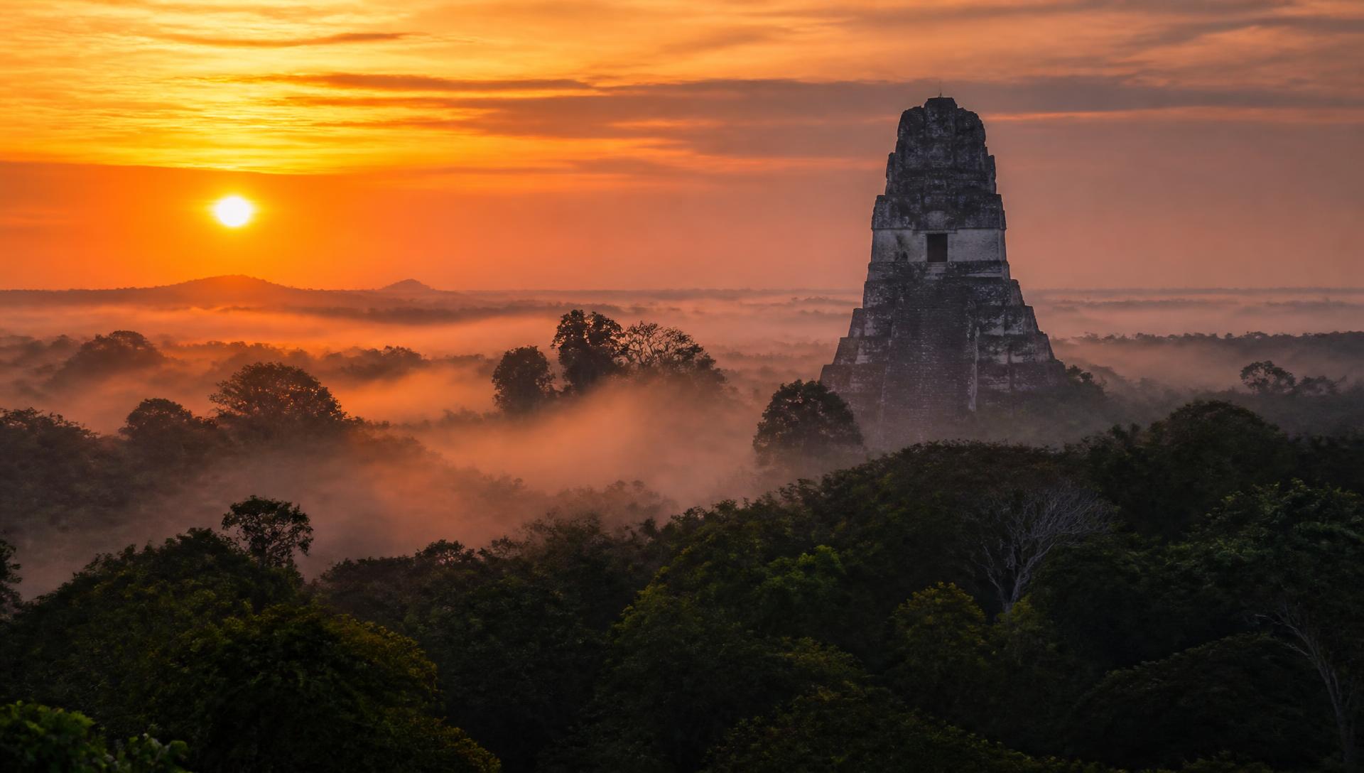
Tikal, in Guatemala's Petén jungle, is the centrepiece: five towering temples in a plaza clearing, howler monkeys overhead and toucans at dawn. Sleep inside the park or in nearby El Remate so you can be at Temple IV early; the sunrise tour is atmospheric but often fogged in, a 6am entry on your own is usually better value. Yaxhá and Uaxactún nearby are near-empty alternatives.
Palenque in Chiapas has the finest carved stonework and a jungle setting with waterfalls; combine it with Agua Azul and Misol-Ha. Calakmul, deep in a biosphere reserve, is the wildest of the lot: jaguar country, and you climb for a canopy view in every direction.
Copán in Honduras is small but has the best sculpture and stelae anywhere in the Maya world, and it is an easy hop from Guatemala. Quiriguá, on the way, holds the tallest stelae ever raised.
For the peninsula's own cluster. Chichén Itzá, Uxmal, Cobá and the cenotes: see the Yucatán guide, which pairs naturally with this route.
Guatemala's highlands
Antigua is the obvious base: cobbled streets, ruined baroque churches, volcanoes on three sides and Spanish schools on every corner. Hike Acatenango overnight to watch neighbouring Fuego erupt through the night: it is hard, cold at altitude and completely worth it.
Lake Atitlán deserves three or four days. Panajachel is the transit hub; San Marcos is the yoga-and-hammock village, San Juan La Laguna the weaving and coffee co-operative one, Santiago Atitlán the most traditionally Tz'utujil. Boats between villages run until dusk only.
Chichicastenango's Thursday and Sunday market is the biggest in Central America. Further north, Semuc Champey's limestone pools and the cave-and-river trip at Lanquín are the classic detour, a rough road, but a memorable one.
Belize: reef, caves and cayes
Belize is the water half of the route. Caye Caulker is the barefoot, budget-friendly base; Ambergris Caye is busier and more developed. Snorkel or dive Hol Chan and Shark Ray Alley, and if you dive, the Blue Hole day trip from Caulker or Turneffe.
Inland, San Ignacio is the launching point for ATM cave (Actun Tunichil Muknal), a wade-and-swim through a river cave to a chamber of Maya sacrificial pottery and skeletons; no cameras allowed. Caracol and the Mountain Pine Ridge waterfalls fill another day.
English is the official language here, which makes it the easiest leg to travel independently.
Eating along the route
Guatemalan highland food is stew-based and gentle: pepián, jocón, kak'ik turkey soup, tamales wrapped in maxán leaf and rubbish-strength coffee at home despite exporting some of the world's best (seek out a co-operative tasting in San Juan or Antigua).
Chiapas brings tamales chipilín, cheese and cacao-based pozol; Belize means rice and beans with stew chicken, fry jacks for breakfast and ceviche from a cool box on the dock. Street-food discipline: eat where there is a queue and turnover.
Getting around and crossing borders
Shuttle minibuses link the tourist circuit (Antigua–Atitlán–Chichi–Flores–San Ignacio) and are worth the modest premium over chicken buses for long legs. Overnight buses between Flores and Antigua/Guatemala City save a day. Flores–Belize City and Palenque–Flores are both routine crossings, but budget several hours and carry small US dollars for the exit fees.
Distances are longer than the map suggests: mountain roads average 40km/h. Three weeks is a realistic minimum for Guatemala plus Belize plus Tikal; add a week to include Chiapas or the Yucatán.
Practicalities
November–April is the dry season and the best window; December–January is cool and busy in the highlands, March–April hot in the lowlands. May to October brings afternoon rain and muddier back roads, with hurricane risk on the Caribbean side August–October.
Pack for two climates: Atitlán and Antigua sit at 1,500m and get genuinely cold at night, while Petén and the cayes are hot and humid. Bring a head torch for cave trips, sturdy shoes, and cash. ATMs are sparse outside towns.
Check current advice before you travel; petty theft and route-specific advisories change. The live advisory banner on your matches covers this.
For a Guatemala-adjacent volcano-and-lake focus, the highlands leg above is the core; for a pure ruins-and-reef trip, pair Tikal with Belize and skip the highlands.
Want to find more places like Ruta Maya (Guatemala, Mexico & Belize)?
Answer a few questions and get matched to 170+ destinations worldwide.
Find my matches